Visualization template · Travel & logistics teams
Flight routes map
Arcs between cities and traffic. Made from one message, so you can get your own in minutes.
Flight routes map
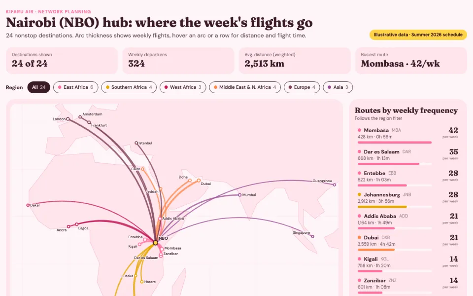
Arcs between cities and traffic
The prompt
Create an interactive visualization of flight routes from Nairobi: curved arcs to 24 destinations on a simplified map, arc thickness by weekly flights, hover tooltips with distance and flight time, and a filter by region. Use illustrative data.
Make it yours
- Change the details in the prompt to fit travel & logistics teams.
- For example, change it so that the hub is Panama City for a Latin American carrier and the map shows 15 destinations grouped into Caribbean, South America and North America.
- Ask for edits in plain words: tone, colors, length, layout or data.
- Share the result by link or export it when you are done.